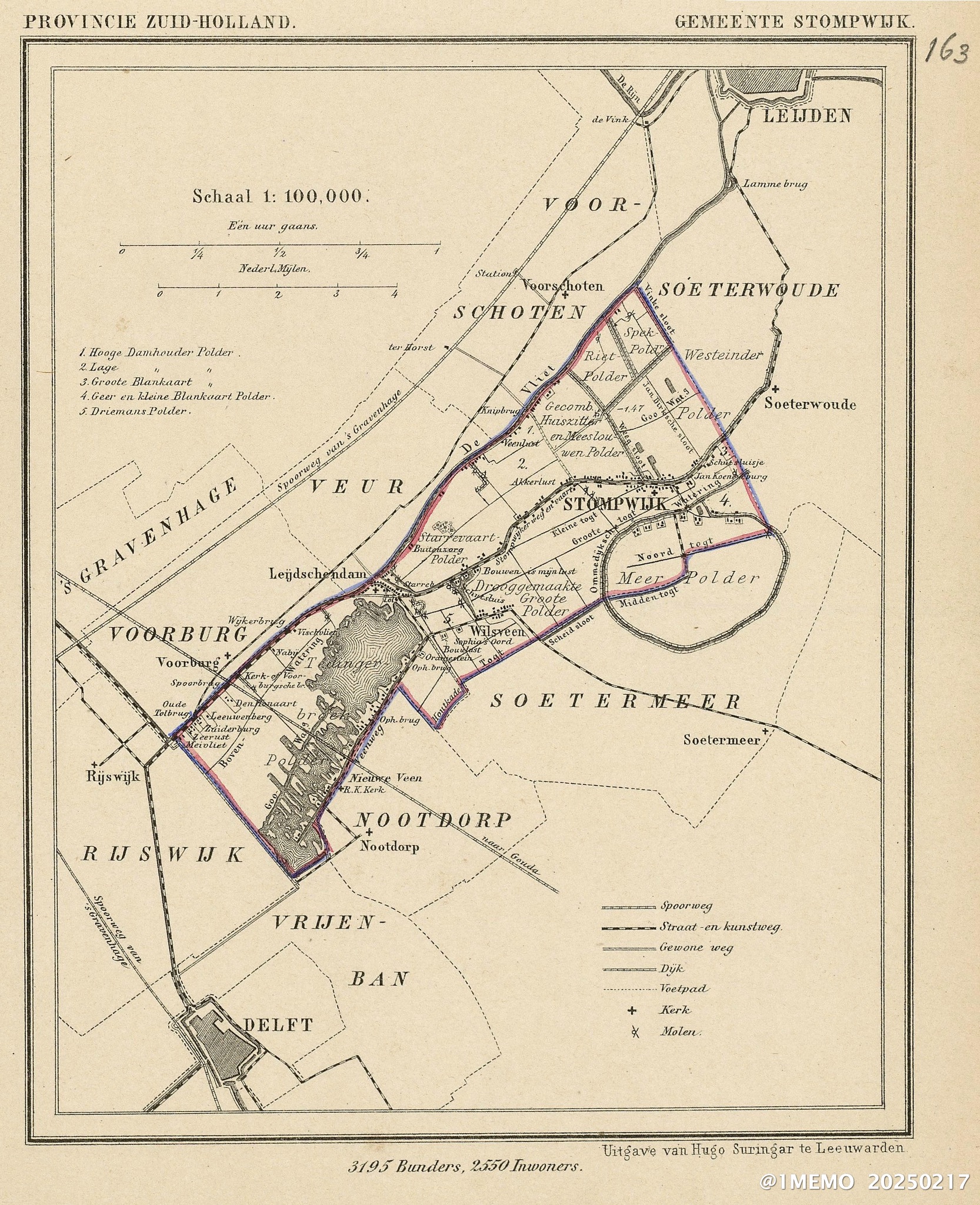
Map of Stompwijk in Holland around around 1865-1870 with the 3 windmills draining water from the Driemans polder in Wilsveen (Map Section 5). Leendert van der Burg, my great-great grandfather, was watermiller at the time on the Middle Mill.
Notes
Map by Kuyper, J. of the former municipality of Stompwijk, around 1865-1870 (currently part of the municipality Leidschendam-Voorburg, South Holland, the Netherlands). Source Wikimedia Commons.
Citation info : Stompwijk Map 1870 • Michel van der Burg • Miracles•Media • @1MEMO 20250217

